Crime mapping in the AI era: why transparency still matters
By Professor Fraser Sampson, former UK Biometrics & Surveillance Camera Commissioner
It’s almost 20 years since colleagues at West Yorkshire Police released the UK’s first prototype crime map. As we pointed out at the time, if knowledge is power, information is the natural energy source on which it depends – and within the criminal justice sector, that was in short supply. It was clear that in the future, not only would there be a growing public demand for access to crime data, but also that the police would increasingly depend on data captured by citizens themselves. Both have happened.
Beatcrime was the first police map to show crime data at street level specificity and was built with considerably less than the £4 million investment announced by the UK government for a real-time and interactive crime map of England and Wales.
Two decades ago, the principal reason for withholding detailed crime data at the outset was its accuracy: specificity was equated with ‘dangerousness’ and even illegality. Crime mapping was simply too true to be good.
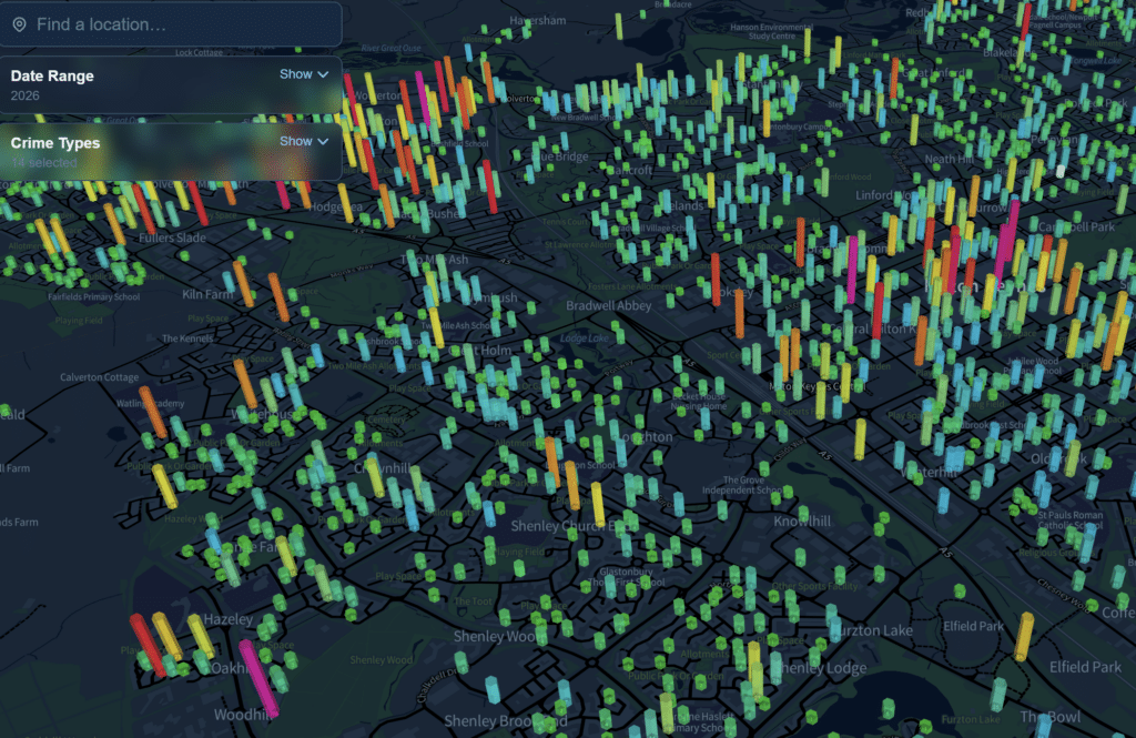
This was paradoxical. Participation of the citizen is central to the policing model for England and Wales, yet the police were keeping key data on types, times and locations of volume crime from the very communities being asked to help them tackle it. West Yorkshire Police Authority decided to publish crime data at street level using ‘dots-on-maps’ and Beatcrime became the first accessible and interactive police data system in England and Wales to give the public local, up-to-date crime information on a map. For the first time people could view the crime picture of their street, with dots marking the location of crimes reported in the previous month and as bar charts, comparing recorded crime levels with those for the previous year.
Much has changed since then, not least the technology. But, as the new AI-powered interactive displays are being worked up, the arguments for and against crime mapping look familiar. Although specificity was popular with West Yorkshire residents, the general approach among police forces has been to generalise, preferring ‘choropleth-style’ maps that cover broader areas like weather patterns. Such displays imply that the designated areas share the same risk levels and fail to reflect often significant differences between streets or even ‘blocks’ along the same street. Police officers the world over know that crime is not isobaric.
Nevertheless, the Information Commissioner’s Office wrote to several police organisations urging great caution before publishing detailed crime data along the lines of the emerging CompStat model in New York City. Some organisations like the Jill Dando Institute warned that publishing data that was too specific or insufficiently contextualised could increase the public’s fear of crime, generating negative debate about the performance, accountability and transparency of police forces and crime reduction partnerships. Critics argued that revealing high levels of crime in a specific locality would reduce confidence in some areas, supplying official confirmation of people’s suspicions that things are in fact as bad as they seem—or perhaps worse. At the same time, international research found the coy approach to publishing meaningful crime data when compared to the USA and Canada had turned Britons into ‘passive bystanders’, uninformed about crime and less likely to participate in maintaining justice than citizens in other countries.
Further opposition was stoked by another great British preoccupation – house prices, with some fearing accurate crime data would have a negative impact on property values in ‘red’ neighbourhoods.
As other forces began to map recorded crime, Mayor of London, Boris Johnson, asked the Metropolitan Police to amend their website for the capital, making the data far less detailed than had been originally planned. In the end, the coordinated national response by the Home Office opted for smoothing over specificity.
Now plotting crime is back on the agenda – the accessibility of information and the technology to analyse it has changed beyond recognition. We’re living in an era of data inundation and there are plenty of websites overlaying police crime statistics on districts, but not all are useful. For example, the Houses of Parliament and New Scotland Yard are in what one site ranks as the ‘least safe’ area in London. Whether you’re there as a tourist, a commuter or an elected official, what does that really tell you about the place and how it’s policed?
The fundamental crime mapping challenge for policing was, and remains, how to balance the provision of meaningful, reliable data with the law, the operational realities and the expectations of communities.
Technological advances have been accompanied by greater openness in the sharing of policing data generally but, once again, some see risk through transparency. The Metropolitan Police have recently changed their policy on body worn video and are releasing more footage earlier in the name of transparency but there has been concern about candour and how this may increase fear of crime or jeopardise a prosecution. On the other hand, selectively edited videos of crime are posted online daily which can have that same effect. Time stamped and geotagged, they’re highly specific – and increasingly deepfaked. Shouldn’t the police help correct any biased or incomplete narrative? Isn’t sharing reliable data more likely to build trust than withholding it?
Police accountability means having the full picture and the West Yorkshire experience showed how people often had a skewed perception of crime and the likelihood of encountering it. Accurate mapping helped people recalibrate their assumptions about policing and publishing definitive datasets can have the same effect for interrelated areas like education, health and welfare.
The UK police still use heatmaps but probably not for much longer. Big Data’s early potential to improve ‘fairness and quality’ in policing has been turbocharged by AI. Crime mapping technology now offers the police and the citizen powerful new ways to parse patterns and pre-empt criminality. Why wouldn’t they both want to use it?
About the author
Fraser Sampson, former UK Biometrics & Surveillance Camera Commissioner, is Professor of Governance and National Security at CENTRIC (Centre for Excellence in Terrorism, Resilience, Intelligence & Organised Crime Research) and a non-executive director at Facewatch.
Related Posts
-
 January 26, 2026
 -
 November 4, 2025
 -
 January 5, 2026
 -
 April 10, 2026
 -
 August 18, 2025
 -
 February 3, 2026
Article Topics
big data | criminal ID | Fraser Sampson | law enforcement | predictive policing

Comments